Set sail on an unforgettable journey through the breathtaking San Juan Islands, guided by expert local knowledge, detailed maps, and meticulously crafted boating itineraries. Master the rhythms of tides and currents to glide effortlessly between islands. Pitch your tent in hidden forested parks, drop anchor in pristine bays, and hike trails that lead to sweeping vistas. Wander the bustling charm of Friday Harbor and the elegance of Roche Harbor—then escape it all in a serene, secluded cove where the world slips quietly away.

++++ ============================= All Posts Below

Current Posts Below

Apr 19, 2020

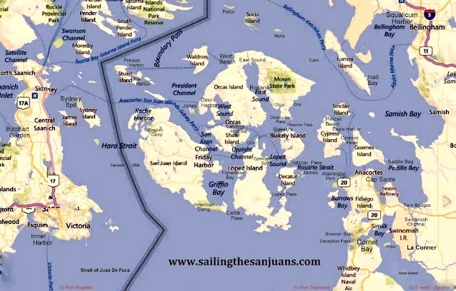
San Juan Island's Map with Marine Parks - Marinas - Cities - Ferry Routes

If you find some useful places on the orientation map below, you will want to click this link of Parks and Islands to zoom in on details of specific parks.

Up close look at all the Parks in the San Juan's


San Juan Islands map showing parks, citys, Canada, Gulf Islands


                                              CLICK ON PIC - IT GETS BIGGER FOR SOME OF US     Map data © 2015 Google

           Lets see, I missed Fort Whitman on Goat Island,
Eastsound (city) is misspelled, Lime Kiln is missing, any more?


Click below to see a satellite view of Cypress Head Campground on Cypress Island