Explore the San Juan Islands with expert guides, detailed maps, and comprehensive boating itineraries. Learn how to utilize the tides and currents to your advantage. Discover the best parks for camping, anchoring, and hiking. Experience the charm of Friday Harbor and Roche Harbor, then relax in a tranquil, secluded cove for the perfect getaway.

++++ ============================= All Posts Below

Current Posts Below

Aug 21, 2018

Who owns the Shoreline above and below the high tide line in the San Juan Islands?


         Probably since before exploration, men have claimed ownership of just about everything above and below the surface of the ocean, and this includes the San Juan Islands.

Thatcher Pass from on top of James Island on clear sunny day

         The good news is that the arguments of who owns what and where are pretty much settled.  The bad news is that, as a boater staring across the water at some desirable beach or mudflat (if there is such a thing) you don’t know what to do, or where to land.


       For the most part, you may anchor anywhere you want, except vessel navigation channels and marked farms. It doesn't take much common sense to figure out not to anchor in the middle of a boat congested narrow thoroughfare, (marked or not) but some daydreamers will do just that. 

        Just because it’s legal to anchor doesn't make it a good idea.

 You can walk most beaches, below the normal high water line, but many properties own the adjacent tidelands and may or may not be marked. Not all shorelines have beaches and so private land will extend to the water’s edge.  Most of the dry land (above high water) is private and you will be trespassing if you come ashore and hike into the woods.  Some landowners don’t care if you come ashore, and some do.  Many will have signs that alert you to their wishes and you should respect their wishes.  If it were me I would not anchor off shore from a sign that said no trespassing, why ruffle someone’s feathers by anchoring or walking in their backyard.


      There are places, marked and some not marked, where seagrass has been damaged, and signs ask you to anchor elsewhere.


Who’s not for being an environmentalist? Just move along, there’s plenty of other places to drop a hook.


      At resorts and marinas, (Roche, Friday, Deer, Rosario, Fishermans, etc, etc etc., you will usually see boats anchored nearby, just follow their lead and anchor your boat too. Ask someone where the dinghy dock is and go spend some money.  You may be thinking, how long can I anchor and what’s the cost, so I remind you it’s public, it's free, and you can anchor as long as you want.


       There are some exceptions, but we don’t need to discuss them now, or ever, so go have a good cruising day. 

Jul 22, 2018

Inconsiderate Boating

       My boat leaves a huge wake at times.  I know because I can see it.  I also know how to minimize or eliminate my wake entirely and so do all the other skippers out there.

       So here's the rub, why are there so many witless morons creating monster wakes where they cause damage? I don't believe for a second that they aren't aware of their wake.  I believe they are jerks and inconsiderate asses that don't deserve the privilege of driving a boat.

      I'm not saying to drive slow or at no-wake speed all the time, I'm saying to pay attention to the damage your wake is doing.  Not only are you being an ass but you are liable for damage or injury caused by your negligent driving.  

     If your wake swamps or rolls a small boat, you are liable.  If your wake smashes a moored boat into a float causing damage, you are liable.  If your wake capsizes a kayak causing a drowning, you will be held liable and probably go to jail.

       If you think this is only true in marked no-wake zones, think again, you are wrong.  You are responsible for your wake damage anywhere and everywhere, marked or not.   That 200-foot rule many signs and publications tout is not your free pass to be irresponsible, you are still liable for damage your wake causes.

There, I'm done.

Jul 4, 2018

Is a Bag of Beans the best way to insure Boating Pleasures?

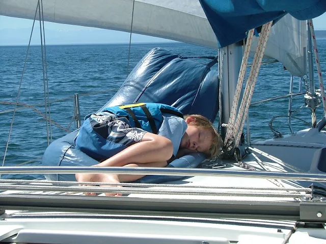
Bag full of Beans travels to the San Juan Islands!


     Many years ago I happened to have over to my house, for reasons I don’t remember, a person that mentioned he had circumnavigated. He asked would I like to see some of his pictures. 

Of course I said yes, so for the next several hours I was enthralled by this sailor’s story and pictures from around the world.  I have incorporated some of what he said into my own thinking and actions, after all what we learn from others may be hard earned by them, but free to us. 


        This brings me to bean bag chairs and boats. This unnamed world cruiser said that his favorite chair for his boat was a bean bag.  A bean bag, you’re kidding, do they still make them?  Well, yes they make them and $20 later I had a brand new bean bag chair for my 28 foot sloop.  I store it in the v-berth along with bags of sails. My kids quickly learned that it conformed to uneven decks, it could be crammed against shrouds, masts and stanchions, and made uncomfortable cockpit combings a thing of the past.  The bean bag chair has become a must have  piece of cruising/camping equipment on my boats, and while it’s true, storage is limited, tough decisions have to be made -- the bag-o-beans wins out even if it means leaving the 150 Genoa home.

Bean bag chair is a boats most comfortable seating
Bean Bag is carbineered to mast, crew is not
Canoe Pass bridge in the San Juan Islands
Coveted bean bag chair providing extreme comfort in Deception Pass
Sailing the San Juans and bean bag chair
     underway, under sail, unaware     

Click Deception Pass below for satellite view

Jun 21, 2018

The Fastest Way to the San Juans On Your Own Boat Begins in Anacortes at Washington Park or Cap Sante

Traveling to the San Juan's requires a starting point,
 a jump off point where you can leave your rig.
"Washington Park" and "Cap Sante Boat Haven" in Anacortes fill the bill.


map of Washington Park and Cap Sante in Anacortes Washington


Washington Park has a campground

 and a boat ramp with a float.  You can reserve your campsite in advance, launch and retrieve your boat every day to make day trips or take an extended cruise into the islands knowing your campground is waiting for you when you return.  You may also choose to not stay at the campground, just launch your boat, and leave your car and trailer in the long-term parking lot while you're in the San Juans.


Cap Sante does not have a ramp but has a sling 

and a travel lift to launch your boat, they can also assist in stepping sailboat masts. Guest space is usually available at the dock and long-term parking for your car and trailer are just steps away.  You should make arrangements ahead of time for the travel lift and guest docks


There are several other places I recommend over these two depending on where I'm going and other plans.
Take a look at this post >>    Trailer boat ramps


Click Anacortes below for satellite view

Apr 23, 2018

Is Squalicum Harbor in Bellingham the best way to get to the San Juan Islands? - YES!

What and where is the best launch ramp with 

long-term  parking

     Places to go, and places to travel are easy to find in the San Juans.  For me, cheap travel is part of the deal.  What can be less expensive than going on a cruise with your own boat, it's like having your own condo rental or vacation house with you all the time. Okay maybe boat camping is a little squeezed, but the big problem is, where do you launch, and where do you leave your car for a week or more?   Squalicum Harbor in Bellingham is a resounding first choice and parking is free, (Update: better check with harbormaster) no others come close for time, distance, convenience, or facilities, none in my opinion.!

Satellite view of the Squalicum Harbor launching ramp in Bellingham, Wa

Squalicum Harbor launching ramp chart map showing all the slips and docks and ramp


     Marked on the chart above with red dots is a four lane two float, all tide modern 24/7 ramp, parking, and overnight visitor docks. The parking lot is huge and they have an overflow lot too. Freshwater wash-down hoses are free for you to use.  The ramp fee is $5 and there is no parking fee, that's right it's free, even long-term is free.  (call about free) How cheap can you travel, ( I mean less expensive) Next to the parking area is a restaurant, 24-hour bathrooms, and showers. Across the street is a marine store.  Out on the floats, they have transient boater dock space.  Payment is self-serve at the automated kiosks.


      You may think by looking at maps that Bellingham is far from the Islands, but it is actually the closest jump-off point for travel to Sucia, Matia, Patos and Stuart.  For those camping and traveling on a budget it's your only choice.link to really great map with parks marked, click here


Click Bellingham link below for satellite view

Mar 10, 2018

Victoria Cruise Itinerary and Customs at Roche Harbor

Note: this  is a very old post I am re-posting so some prices will be off.

Suggested Cruise to Victoria BC with Whale Watching
 and San Juan Islands Stop Overs

This article is for first timers to the San Juan Island area and has the answers you may be looking for.  Timeless advice to make your first trip a fun success.

  • places to launch and stay on your boat
  • distances between stops
  • customs and immigration
  • alternate planning
  • what to expect
  • basic boating information 

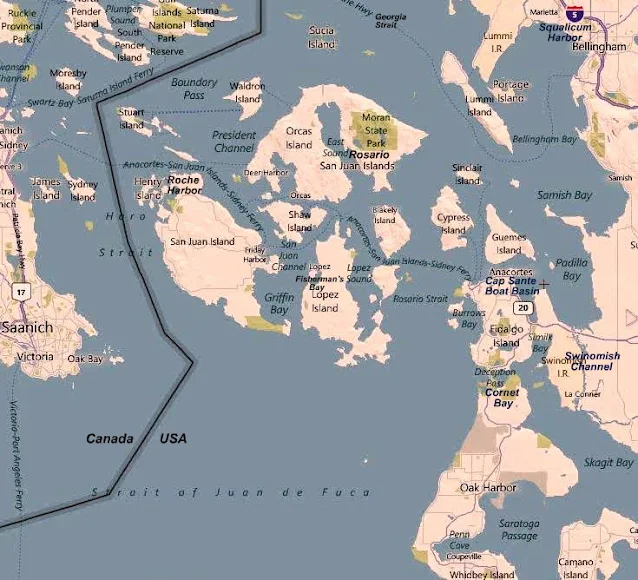
Study this map and familiarize yourself with names and places. 
 (Find Victoria, Roche Harbor, Swinomish Channel, Deception Pass)

Map showing Victoria Canada, San Juan Islands, Roche Harbor, Friday Harbor, Squalicum Harbor, Anacortes


Lets start this Cruise at Cornet Bay in Deception Pass State Park

(Your going to Canada and back, did you remember to bring your passports and Children ID's? the rules are changing)


Cornet Bay boat ramp in Deception Pass park

Boat launch at Cornet Bay (Deception Pass)

Day one, you arrive at Deception Pass 

and its probably late in the day and your tired, so lets plan on spending the night right here  on the boat securely tied to the dock at Cornet Bay.  You will pay a launch fee and $10/day parking, plus 50 cents a foot for spending night at dock. Pay at the self serve kiosk. If your not sure of when your coming back simply estimate, leave a note explaining, the ranger will understand.  The ramp is very good, all tide. The parking is huge, you will not have a problem.

      There is a very minimal park store, but you should have done your provisioning in Anacortes.


Deception Pass bridge

Heading westward facing an incoming current, (another ten minutes and we wouldn't have the speed to overcome the 7+ mph current)

Day two, leg #1, our destination is Friday Harbor,

 but first you must time the pass.  You should already be familiar with the tide levels and  times at Deception Pass (download a page from any of of dozens of sites including NOAA) so cast off at high or low tide. You can be  half an hour early or late, this gives you a one hour window. (it takes just ten minutes to reach the pass from the dock)  If you are catching a falling tide (current is going out to sea) you can be very late but standing waves may scare you and the crew as you take a fast sled ride and shoot out into the Strait of Juan De Fuca.  If you are late and  head out on a rising tide, your boat may not have enough speed to overcome the in rushing torrent, and your stuck until the next slack water. The pass is not a problem, it is narrow with the fastest water for only about 250 feet, but slow sailboats can  meet their match every four to six hours.


read more

Feb 23, 2018

Wiring shackles with seizing wire

      I have always read just like everyone else that shackle pins need to be wired so they won't work loose.

      Well when I anchored my day sailor for the summer, I threw together a folding anchor, six feet of chain, some twenty feet of old trucker floating line, an old fender for a float and set the whole thing in about eight feet of water.  But first I hooked the chain and rode together with a galvanized shackle.  I tightened the shackle pin with a wrench.


       My only worry was too much rode and she might swing onto shore at low tide.   My little cove is subject to about two feet of tide, no rogue wakes, no current and very little wind.
       

After about two weeks of coming and going by dinghy, and sailing on and off my poor mans mooring, I was pretty used to and confident my set up was there to stay.  Then one afternoon when I showed up I noticed my anchor line was changed.  Suspicious, I leaned over the side of the dinghy and yanked to the surface my anchor except it wasn't my folding anchor, it was some cast iron thing I have never seen.  I put it back, left my dinghy at the fender float and went sailing, all the time pondering what was going on.
      

At dusk I came in and switched back to the dinghy, on my way out of the cove I swung by a young chap working on his boat and inquired if he knew anything about my missing anchor and rode.
     

He said yes, he had noticed my boat was floating free one day and using a spare anchor he put it back where it belonged.  I thanked him profusely and brought him a bottle of rum the next day.
  

  The lesson I learned that day was to use seizing wire even for temporary things if  failure is unacceptable.  I also learned how smart my choice of the quiet cove was for my anchor buoy and that I still had some paying forward credits after all.
    

 FYI - A few days later from the dinghy, I probed the muddy bottom for two hours with my 12 foot boat hook and snagged my gear getting it all back including the shackle and loose pin. I replaced the borrowed anchor and this time I wired the pin, and that's my story.

Feb 1, 2018

Jones Island is the Absolute Best Marine Park in the San Juans - Period


Jones Island offers a wonderful experience for boat camping and exploring the San Juan Islands. Its proximity to major marinas and harbors, such as Deer Harbor, Roche Harbor, and Friday Harbor, makes it a convenient and attractive destination.


Starting your kayaking adventure from Deer Harbor, with its calm waters, can be a great option for exploring the surrounding areas. Roche Harbor, known for its resort and as a departure point for trips to Canada, is another nearby destination that adds to the appeal of Jones Island. Additionally, Friday Harbor, the largest city and port in the San Juan Islands, is relatively close, making it easily accessible for supplies or further exploration.


With its strategic location and the variety of neighboring destinations, Jones Island offers a great balance between tranquility and accessibility. It can be an ideal choice for families looking to enjoy boat camping and explore the beauty of the San Juan Islands.

This image is of Jones Island Marine Park in the San Juan's


         All of Jones is a state park, the north cove is preferred by power boaters and sailors alike, inside you will find a protected bay with docks and anchor buoys, plus room to anchor if the five buoys are in use.


Topo Map locating Jones Island - post describes camping facilities

        The south cove is favored by kayaker's, there are several campgrounds and the island has running water, fire pits and picnic tables. On a sunny summer weekend it would not be unusual to find several large groups camping with many first time kayakers in guided tour groups.  Offshore are a few anchor buoys.  The south cove is not protected from San Juan Channel traffic or winter storms so the beaches are piled with sun silvered driftwood.

NOAA chart snippet of Jones Island State Park in the San Juans

        The North Cove is absolutely wonderful, There is a brand new dock, anchor buoys, a steep gravel beach (good for dinghy's), and room to anchor. The cove is protected from all but the worst north winds (very infrequent) On shore are lots of tent sites, each with picnic table and fire rings.  There is a nice mowed lawn area for games and grazing deer.  Bathrooms and running water are clean, cool, clear and convenient. 


Jones Island in the San Juans - children feeding deer

Children on Jones Island exploring tidepool at low tide


            The island has several hiking trails, rated, easy and moderate. From the trails are magnificent views of the surrounding islands, and waters.  Bring your camera to Jones, you will want to preserve the memories to show your friends that aren't as fortunate as you.


Boat camping  dock at Jones Island Marine Park in the San Juan Islands

  NORTH COVE DOCK AT JONES ISLAND


Click the Jones Island link below for satellite view

Jan 5, 2018

IDEAS for this summers cruises in the San Juans


      Readers remind me that some places I suggest and visit myself are technically not part of the San Juan archipelago.  This may be true but if we limit ourselves to one zip code, who really benefits. 

That's why the website title includes 
"Surrounding Area"

I don't remember where this is - sorry
   

Note:  these are not ideas I am suggesting for you,  (okay maybe a little) they are places I am thinking about for me to see again.

If you are a newbie, you should go to tried and true hot spots like Roche - Friday - Jones - Sucia - La Conner - Deception Pass. Use the search box - it's all there and then some.


If you have been around the San Juan's awhile you may be looking for new ideas, that's what my list is about. Dates don't really matter, these places are timeless.


       My short list for 2018

  • I would like to spend a few days anchored at False Creek in Vancouver (we really enjoyed Granville Island and Stanley Park) (60 miles, one way) - ouch
  • Explore West Sound,  we haven't entered West Sound for fifteen years. I guess it has been a drive by sound for us. I want to check out the marina and possibly see about making a bike/hike ride to one of  the Turtleback Mt trailheads.
  • Hike Vendovi Preserve. This little jaunt will happen for sure.
  • Visit Lummi Island (we biked it in 2017, it's really flat and easy, I want to do it again)
  • Visit Victoria -  Last time we had three little kids with us, a cramped sailboat and lots of pea soup fog,  just the two of us should be easier if we can avoid any fog.
  • Hike Eagle Bluff  (closed until after July 15) this hike never fails us
  • Take a shot again at bike hiking up  Mt Constitution, probably start at Olga this time
  • I am thinking of skipping 4th of July, but Lopez is on my radar if we go anywhere
  • maybe go see Nanaimo or some Gulf Island Parks (means a lot of motoring) I doubt this will happen. (we went to  Newcastle Park many years ago and had fun, but like Vancouver, it's a lot of motoring) maybe we can ride the current both ways.  
  • Might want to anchor at Smallpox Bay for a night and do some orca watching.

Okay, that's about it. It's not much to choose from. Because of the miles involved, I don't see us visiting Victoria, Vancouver and Nanaimo on the same trip.  I'll let this simmer for awhile and see what floats to the top.  Lately we have fallen into the trap of repeating what we are comfortable with. I don't know if that is good or bad, but now I'm thinking of adding Jones Island to the list.  So should I not go to Jones because I really enjoy it and feel comfortable there?  Seems counterproductive to avoid visiting somewhere you really like.


To see what we ended up doing, click here


Click below on Granville Island Public Market if you are thinking of Vancouver or the Sunshine Coast

Dec 26, 2017

Five Things Everyone Should Know Before Cruising the San Juan Islands

Fun Observations and Frivolous Knowledge  for 

All Boaters new to the San Juan's 

#1 Hugely fluctuating water levels   (tides)

The San Juans have high and low tides every day, some very high, some very low. This means you will need to be prepared to deal with going ashore at locations lacking floats.  The easiest solution is to bring a dinghy; if you don't have a dinghy I suggest you buy a cheap inflatable boat or 2 person kayak for around $75.  Once in the San Juans most people simply tow the dinghy everywhere they go, or deflate and stow it away. Those of you going in a ski boat or skiff may be thinking you can beach your boat, which will work, but only for a few minutes. On a falling tide in ten minutes your boat may be high and dry, unless you can carry it, your stuck until the tide comes back up. On a rising tide your boat will float away while you're on shore.  Since your going to anchor in six feet of water at low tide you will need one hundred feet or more of anchor rode to accommodate a ten foot plus increase at high tide. Smart boaters bring two anchors and rode and a dinghy they can carry up above high tide.

San Juan Islands - very low tide at Matia


#2 Strong Swirling Currents (in places)

San Juan currents are notorious, and the root of many stories. For fast planing boats you can pretty much ignore adverse current; however slower boats live and die by planning passages to get an assist from the current. A typical sailboat may putt along at 4.5 mph, against a 2.5 mph current their real speed over ground is 2 mph.  Going with the same current their sog is 7 mph.  So a ten mile passage takes 5 hours the dumb way or 1 hour 25 minutes the smart way. There are many prediction and forecast books and charts available and online.  While you don't need a publication, I recommend that you buy something and keep it with you. I would also go online and print out a tide schedule for the time and area you expect to cruise.  CLICK BELOW for Rosario Strait at Guemes Channel

NOAA tide forecasts

In a nut shell, here's a simple rule of thumb to follow.  On a incoming or rising tide, the water in most straits and passes flows "north" while during a falling tide the water reverses and flows "south."  When the current hits an island straight on, the water will split and flow around the island usually at a slightly higher speed creating eddies at headlands and the tips of the island.

San Juan and Gulf Islands Current Atlas


San Juan Islands current charts


#3 Weather could be fog  (pea soup is the term)

You can get lost in the dark, in the fog, or just plain lost on a sunny day.  You need to bring with you a chart, and you would be smart to protect it from getting wet or torn up. I sandwich mine between two clear acrylic sheets held together with velcro.

Some will say the chart needs to be new and of the highest resolution, which may be true for ship captains and other navigators.  What were talking about here is not getting lost, even a google print out may do the trick.  If you are going to boat in the fog you must have a compass, and  GPS, a portable handheld GPS will do fine and some new phones may do the trick too. (in thick fog you will go in circles and be totally disoriented without a compass) A gps will not replace a compass in rough water and fog, a gps is much too slow  reacting when you are getting spun from broadsides or quartering waves (broaching) you need both.   Many times in the San Juans visibility may be down to 3 or 4 miles and you think you can sneak across some open water to the next island, and you probably can, but if the fog thickens to pea soup you will be glad you have your compass and GPS.  BTW, fast boats can't always go fast when waves and swells stack up. And only very dumb skippers go fast when they can't see.

San Juan Islands fog hiding a ferry
See the ferry approaching the anchored sailboat?

#4 Wind or lack of wind  (sorry sailors)

OK, here's some bad news for sailors.  The San Juans are not known for great sailing winds in July and August. Out in the straits (Haro, Rosario, Georgia, Juan De Fuca)
you may get some decent sailing, but inside the islands, don't bet on it.

Sailing with reefed main in cold weather
Sailing in April rain with reefed main


#5 Crowd control   (no worries)

Most likely you won't have any problems with crowds except on the 4th of July and Labor Day.  The good side is that you will always find a place to anchor, even on holidays, the dinghy ride may just be a little longer for some.  Most marinas take reservations and you may as well take them up on it, but you don't need to.   I suggest you slow down a little and enjoy the freedom of not planning ahead, take one day at a time and see where you go.  Lastly, because this area is so close to Bellingham and Anacortes many boaters are day boaters.  At the end of the day they head for home, leaving some resorts and parks half empty, especially on weekend Sunday nights. Monday or Tuesday are good days to begin your outing if you want to be alone.
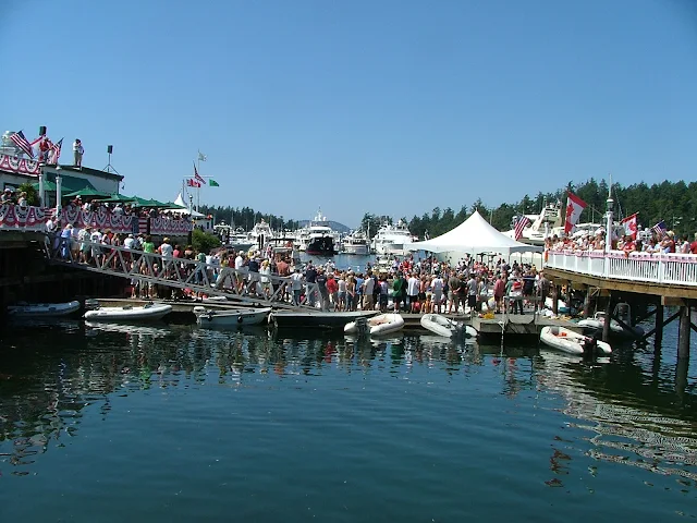
Roche harbor dock on holiday
Fourth of July celebration in the San Juan Islands at Roche Harbor Resort
Roche Harbor summer celebration with children

Roche Harbor balloon chasing contest


Roche Harbor 4th of July balloon contest for kids in dinghys
yes, there was room for more, lots more


Expenses

DNR buoys are free (Cypress Island) State Park buoys are $10, many park floats are 50 cents a foot,  Marinas charge between 75 cents and $2 a foot. Gasoline is a little more expensive than on land, but not much more.  Food, groceries, ice are just a little more than the mainland but very fair priced overall.


How many days to plan

Plan a minimum of four days, but up to two weeks depending on what you like to do. (I like to sit on the dock at Jones Island and read my book between naps and walks, then I make a campfire in a empty tent site and cook Kielbasa followed by a glass of wine. Then retire to my boat for a good nights sleep.  The next day, do it again)


Salt Water

Salt water drys sticky and does not suds up well with soap, you will get it all over you and your boat, count on it.  After a week you will look forward to a shower.  Your boat will be covered with salt crystals.  Most marinas have little water and don't want you washing your boat.

Squalicum Harbor in Bellingham has boat and trailer fresh water wash down hoses in the parking lot.  You should use them each time you dunk your trailer.


Provisions

For the most part you will want to provision before you leave on the boat.  Anacortes and Bellingham have all the big stores and each has a West Marine store.  All the resorts and towns have grocery stores, if you drive a fast boat, supply's may be only minutes away, putt putt's should work a store visit into your circuit.  I say circuit because most cruisers will follow a circle of some sort trying to hit many stops.  We find that ice needs renewing after four days, so a stop over at Friday Harbor, Deer Harbor, Roche Harbor, Blakelys, or Orcas landing fills the bill.  All these places  except Orcas, have gas and showers.  Showers will cost a handful of quarters so be quick or be poor. Cold showers are free. Lopez Village has free showers but no dock so you will need a dinghy.how to dinghy to Lopez village


Garbage

All the parks are pack it in and pack it out, the marinas have dumpsters.  If you are new to boat camping you will find garbage to be a pain because you are not used to storing everything in your boat.  Little things like empty water bottles suddenly take space you don't have.  You must give careful thought to what you are bringing, and the garbage it will generate.  We don't use disposable bottles, minimize pop consumption, and try to have campfires to burn burnable trash.  It is against the law to toss anything, (even a apple core) in the water.


Animals

Your dogs must be on a leash, period, everywhere.  Raccoon's are on all islands and will climb right into your boat or kayak in the day time if you let them.  Deer are all over too, but they shy away, except on Jones Island where you can hand feed them.

Otters live under most floats and docks, they will crawl all over your boat, get into things and make a mess.  Otters also will mark their territory by pooing on your stuff, dock lines are a favorite.

Bathrooms

All the parks have nice composting toilets, (each island mentioned for overnight is a park) the rangers service all parks on a regular basis.  You will be pleasantly surprised at how clean the facilities are.

Where to go:

Your destination is simply that, its the journey getting there and the experiences on the way that make a trip a wonderful vacation. Try the links below for some Island Park descriptions.

Emergency's 

Bring your cell phone and charger, bring at least a portable handheld marine radio, bring basic first aid kit, call the Coast Guard, they can be there pretty fast, or arrange for vessel assist on your credit card, bring a friend with a similar boat, then you can help each other.


Dec 2, 2017

Free Camping in the San Juan Islands


  Washington State DNR land (department of natural resources) is not state park land, it is DNR land and offers five amazing and free camping spots in the

 San Juan Islands area.     


Before you pack up and get on your way, let's define what free means and where the San Juan Islands are located.  For some, free may mean no charge for camping but may fail to add in the cost of a new boat or kayak and tons of gear.  For others, anything less than the price of a five star hotel and plane ticket is a steal.


    The San Juans are arguably defined as part of an archipelago including but not limited to the islands of San Juan County Washington. Therefore, including nearby islands  with other zip codes seems appropriate when planning a camping trip to the San Juan's


     All are first come and no reservations and only accessible by boat. All are pack it in and pack it out.  Facilities are maintained by local volunteers and clubs.


  1. Pelican Beach on Cypress Island
  2. Cypress Head  on Cypress Island
  3. Lummi Campground on Lummi Island
  4. Pt Doughty on Orcas Island
  5. Griffin Bay on San Juan Island
    

     Grifffin Bay:       

     Five campsites, each with tables, fire rings, one pit toilet. Bring your kayaks ashore or anchor off and come ashore by dinghy. One anchor buoy is provided. Enter this latitude and longitude into google search or your gps or your boats plotter to find the campsite 48.475944 N, 123.009857 W Another method would be to  cruise along the west shore of Griffin Bay ( San Juan Island side) looking for a beach landing  and buoy halfway between Fourth of July Beach and Low Point on your NOAA chart.

Free DNR campsite on Griffin Bay with Mt Baker in the background
Griffin Bay free camping


     Point Doughty:

     Three campsites, fire rings and a toilet are on this lonely and exposed point on the north side of Orcas Island. Use this lat. and long. to locate on a map or chart, 48°42'42.2 N, 122°56'58.3 W


     Lummi Island campground:

 is easy to find but here are the coordinates.  48.659223 N, 122.614348 W.

Beachfront free camping in the San Juan Islands at Lummi Island campground

Kayak campground marine park San Juans at Lummi Island Campground


Anchorage cove at Lummi Island campground in the San Juan Islands

Lummi Island Campground is reached from a small cove on the southeast side of Lummi Island 

just south of Smugglers Cove, Inati Bay,  and  Reil Harbor. 
Your best landmark clue will be the sign on the bluff.
click here>>  Easy directions to Lummi Island Campground


     Cypress Head Campground:

This kayaker and boaters and hikers dream destination is on Cypress Island a short 5 mile paddle from Anacortes or Washington Park. Cypress head is the eastern most tip of Cypress Island jutting out into Bellingham Channel just north of Deepwater Bay. The gps coordinates are 48.568919 N, 122.670692 W


Cypress Head campground in the San Juan Islands
Cypress Head point creates a nice protected bay with anchor balls and a very dinghy and kayak friendly gravel beach. Trails connecting to the the rest of the island are across the narrow isthmus.

     Pelican Beach:

     This free waterfront campground on Cypress Island is very popular with kayakers, power boaters, sail boaters, everyone likes Pelican Beach.  It even has ADA compliant composting toilets. The shore is lined with about half a dozen campsites, each with tables and fire rings, directly offshore are anchor buoys. The easy trail up to the top of Eagle Bluff begins at the water edge. To find Pelican Beach simply follow the east side of Cypress Island north about one mile past the Eagle Harbor anchorage. If you run past the end of the island, turn around, you're a quarter mile too far. Here are the coordinates.  48.603400 N, 122.704134 W

Free San Juan Island camping at Pelican Beach

Free San Juan Island camping at Pelican Beach

Free San Juan Island camping at Pelican Beach

   
That's it for free camping in the San Juan Island area.  The Washington DNR has lots more free camping in other areas that are highway accessible.
Click here for a complete DNR map. or copy and paste this url.   https://wadnr.maps.arcgis.com/apps/Shortlist/index.html?appid=98a7fe4ea3764440ad59f0d9b0b280e3


Follow this link below to Cypress Head WA satellite view

Nov 1, 2017

Cypress Island trail map

Cypress Island DNR map


To view larger image,  try right-clicking and open in new window and then look for plus/minus icon.
The best way, is by clicking or pasting the url below and you may then enlarge the image without it being blurry.
https://file.dnr.wa.gov/publications/amp_rec_updated_cypress_island_trail_map.pdf?yh0w7u


San Juan Islands trail map - Cypress Island
Cypress Island trail map


Try this link below to go to a satellite view of Eagle Harbor

Oct 27, 2017

Important Camping Equipment - List - for Boat Camping


By important, I mean important for camping, not that my list is important.
beaching dinghy at James Island in the San Juans

Camping and cruising equipment list

      Over the years, camping aficionados tend to collect everything needed.  They learn from  painful experience what not to forget - again.   Packing for them is just a matter of grabbing prepacked gear. They store it stuffed into one pack, one closet, or in my case, one group of Rubbermaid boxes. Everything is kept together so that when it is time to load up and go nothing important is forgot or left behind.  We call ours  "camping gear,"  and "camping boxes," and all of it is stored on the "camping shelves." 


         In our gear boxes you will find  rolls of aluminum foil with only six inches left, dead spray cans, water logged matches, and barely functioning openers, corkscrews and  rusty grimy pliers.  Did I leave out dim flashlights?


       Rather than list a truly massive list of mostly unneeded items, I thought I would attempt to list the important things that really impact me when forgot. Like my sleeping bag or coat, both I have forgot.


This is a boat camping list, 
not surprisingly, it doubles as a car camping list:


folding saw
ropes and tarps
baby or folding shovel
flashlights -  tested, with extra batteries
fire starting system or plan
stove or cooking system and fuel
fry pan
cooking pot
coffee system
bucket with bail (use for hauling water or bailing or storing icky stuff))
plastic bags big and little
sanitation needs
sponge or rags and towel
soap or detergent
water proof and animal proof food containers
kitchen stuff - spoons, openers,
folding chair
good knife or multi-tool
emergency tool kit
sleeping pad
sleeping bag
tent (for some)
water jugs
layered clothing for hot, cold, and rain
hat
mosquito repellant
suncreen
Added in 2023    >>steel wok for campfire cooking

Some of the items don't belong in a gear box (like clothing) but should be listed.
For those of you that need more, try my
Mother of all packing lists - click here > Mother of all packing lists


Click below for view of Rosario Resort

Sep 26, 2017

Twenty Marine Parks - Twenty Public Docks - Five Boat launching Ramps in the San Juan Islands


Map of San Juan Island Area
With selected Parks, Docks, and 
Trailer Boat Ramps

Map of San Juan Islands area parks, docks, trailer boat launch ramps

The  boat ramps (purple) are all on the mainland
The ramps in the islands are not suitable for cruisers.


 •  Boat Ramps = Purple    Parks = Red  •  Docks = Green

Most docks (floats) are in parks, resorts, marinas and may be used for overnight camping. Boat launching ramps have long term parking.  Parks without docks have anchor buoys or areas suitable for anchoring.


Click below for Cornet Bay Boat ramp

Aug 23, 2017

Ten lessor known places to visit in the San Juan's


     Everyone knows about Rosario - Friday Harbor - Roche Harbor and Sucia Island.  Of course, they are famous and not to be missed. 

But some of the best San Juan area 
destinations are much less traveled. 
And even less talked about.

  Out of the way places have secrets where a little local knowledge may turn a ho-hum cruise into a truly memorable event.  I am listing and describing some of our favorites, feel free to make them yours too.


   Not in any order or preference!

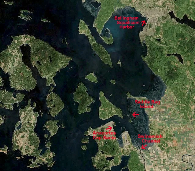
   #1  Saddlebag Island

       At the top of Guemes Channel northeast of Anacortes in Padilla Bay is diminutive Saddlebag Island State Park.


       Saddlebag has only 24 acres, its distinctive dog-bone shape creates two teeny bays. The north one suitable for  two anchored boats, or only one if the skipper hogs the middle on a long rode. We have always been able to anchor fifty feet from shore.  The dinghy ride is short and sweet, the gravel beach is friendly and steep.  The bay catches a little flotsam and wayward seaweed so an aroma may be mixed in with treasures you find.


      The narrow center isthmus holds a small campground and outhouse (newer).  Hiking the shoreline trail is easy and follows a handy figure eight shape affording views in all directions.  Being less than two miles from Anacortes makes Saddlebag an easy kayak destination.


      The waters on the east side of Saddlebag are shallow and rock strewn, circling the island is a white-knuckle event at lower tides. Your dinghy or kayak would be a better choice than the mother ship if you are determined to gunk-hole.


      We stop at Saddlebag for lunch and a hike, overnight if it is late, or just a quick anchor and hike.  We always see something new, and never go away unhappy.


       Saddlebag may only be rated as  five star, you will be glad you stopped by.


Saddlebag Island State Park, for quiet anchoring only two miles from Cap Sante


    Clickity click

Aug 1, 2017

Bicycle ride from the Lopez Island County Dock at Hunter Bay to Iceberg Point on the Strait of Juan De Fuca


       We  spent the night at the dock on James Island.  Our plan was to ride the morning current south through Lopez Pass and over to the county dock at Hunter Bay. 

 Next we would unload our bicycles and ride to Agate Beach where we would then hike to Iceberg Point.  If time permitted after returning to the boat, we would whale watch while cruising up Haro Strait on the outside of San Juan Island to spend the night at Garrison Bay or Roche Harbor.  This seemed like an ambitious but doable first full day of our loosely planned vacation.  Keep reading and find out what really happened.


         We left James late (9am) and arrived at Hunter Bay early (9:45), so far so good for the first 4 1/2 miles.


          Spotting the  small county dock from a distance was difficult because a little rocky islet blocked our view until we were right on top of it.  Half the boat hung out from the  tiny cargo loading space, but we got the bicycles off without any problem, and then moved away and anchored in ten feet on a rising tide.


Hunter Bay, county dock and launch ramp on Lopez Island

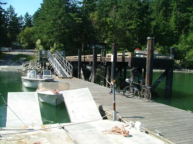
The county dock and ramp at Hunter Bay is for public use, and is primarily used by nearby local residents.  Like all county docks, the signs say you may not spend the night but our experience around the islands is that the two hour rule is largely ignored.  Under the gangway is a spot for dinghy's and next to our bicycles is a spot reserved for loading and unloading only.  Placement of pilings makes much of the float unusable. Anchoring nearby is easy and the bay is well protected except from northerlies.


Hunter Bay in the San Juan Islands, Orcas Island in the distance

In the far distance you can see Orcas Island, so any north winds building waves will be coming all the way from Eastsound and can be a touch big, just like southerlies coming from Hunter Bay tend to be uncomfortable when they reach the top of East Sound -- touche'

Southend Store and restaurant is about a two mile walk with a pretty significant hill to go up and over.  Off to the left where the cove is  more protected are a number of cruisers bedded down.  All in all, this is a pretty peaceful place to hang on the hook or come ashore.

   We tied up in the already crowded dinghy spot under the gangplank.  We were watered, sun screened and raring to ride to Iceberg Point

 We pedaled a few hundred feet and ended up walking up a rather steep hill the first 3/4 mile.  It was a nice forested walk, we mingled with baby deer and glimpsed homes nestled around towering trees.  Still pushing our bikes, we crested the hill only to find another much smaller hill. Finally we started coasting at flank speed down the other side and I'm thinking, oh boy, we have to come back over this mountain later today in blazing afternoon sun.


            Once out on the islands only south end main road, we merged with and then were left in the dust of several large  bicycle excursion groups complete with chase vans and guides.  We caught up with them resting at Southend Store only to have them fly by us again on the way to Agate Beach Park.  At Agate Beach we may have accidentally photo bombed them while they posed for group photos.  We pushed on for a quarter mile and padlocked the bikes at the trail head to Iceberg Point.


           We are almost at the half way point of our days planned bike/hike, all we have to do is walk the mile or so out to the point and back, then head for the boat like a horse to its barn.  I want to call Uber.


          I will save the  details about Iceberg Point for another day except to say it is the tip of Lopez  Island facing the Strait of Juan De Fuca, and I think it was a great  worthwhile place to visit.  I also think it would be a very miserable place on shore in a storm and downright dangerous off shore in small craft. Our day so far, has been balmy and near perfect except for the sun and pushing bikes up hills.  ("Lopez" the bicycler's island, tell that to my legs)


         On the way back we were overtaken again by fit and trim excursion bicyclists, 

each one wishing us a good day as they sped by. The ones riding tandems seemed extra peppy, even happy.


        We stopped at the same store/restaurant (Southend) on the way back, no other bicyclists were in sight.

 I had been talking about getting a hamburger, coke and fries since leaving Iceberg Point.  We sat down in the restaurant portion of the store at a table with a checkered tablecloth  loaded with chips and salsa. I picked up the Mexican only menu to find pages of burritos, enchiladas and nachos. The hamburger and fries will have to wait.  The pulled pork burritos we ordered were huge and the warm salsa was out of this world good.


       I was ready for Uber or even a stranger with a rusty pickup when we saddled up for the last time an hour later, but the hill coming back was not as steep and we pedaled all but a short section, making it back to the dinghy and Kraken in short order.


Iceberg Point nav aid on Lopez Island, cattle pass in the background

Iceberg Point Nav. aid. In the background is Cattle Pass and San Juan Island. It is a beautiful calm day with a little lingering low haze. Across the Strait of Juan De Fuca we were treated to the snow capped Olympic mountains


Iceberg Point on Lopez Isalnd as viewed from cattle pass


The same nav-aid viewed from the water hours later as we head north hoping to spot orcas, still a flat hazy day. You don't have to ride bikes from Hunter Bay like we did, you can anchor at Agate Beach and make the easy hike out to Iceberg Point.


navigation chart snippetchart of Agate Beach  Iceberg Point Hunter Bay in the San Juans

There is no dock at Agate Beach but you can anchor right in front of the stairs
and hike the short distance to the Iceberg Point trail head. 


The bike ride from Hunter Bay to Iceberg Point is enjoyable and takes you by Southend Store for a handy lunch stop or in my case - directions.


       Our bike and hike was just about perfect, we will  do it again someday. All together we pedaled about 7 1/2 miles, and walked 1 or 2. After loading up we headed leisurely around the south end of Lopez fighting a small current until we cleared Cattle Pass where we got a little boost all the way through Mosquito Pass.  We took a slip at Roche Harbor in time to watch the "Lowering of the flags" ceremony.  When they fired the canon, my day was complete.  I slept well that night.


Click below to see Hunter Bay Satellite views